Strongest in 174 Years: Melissa Slams Jamaica, Life-Threatening Surge and Wind
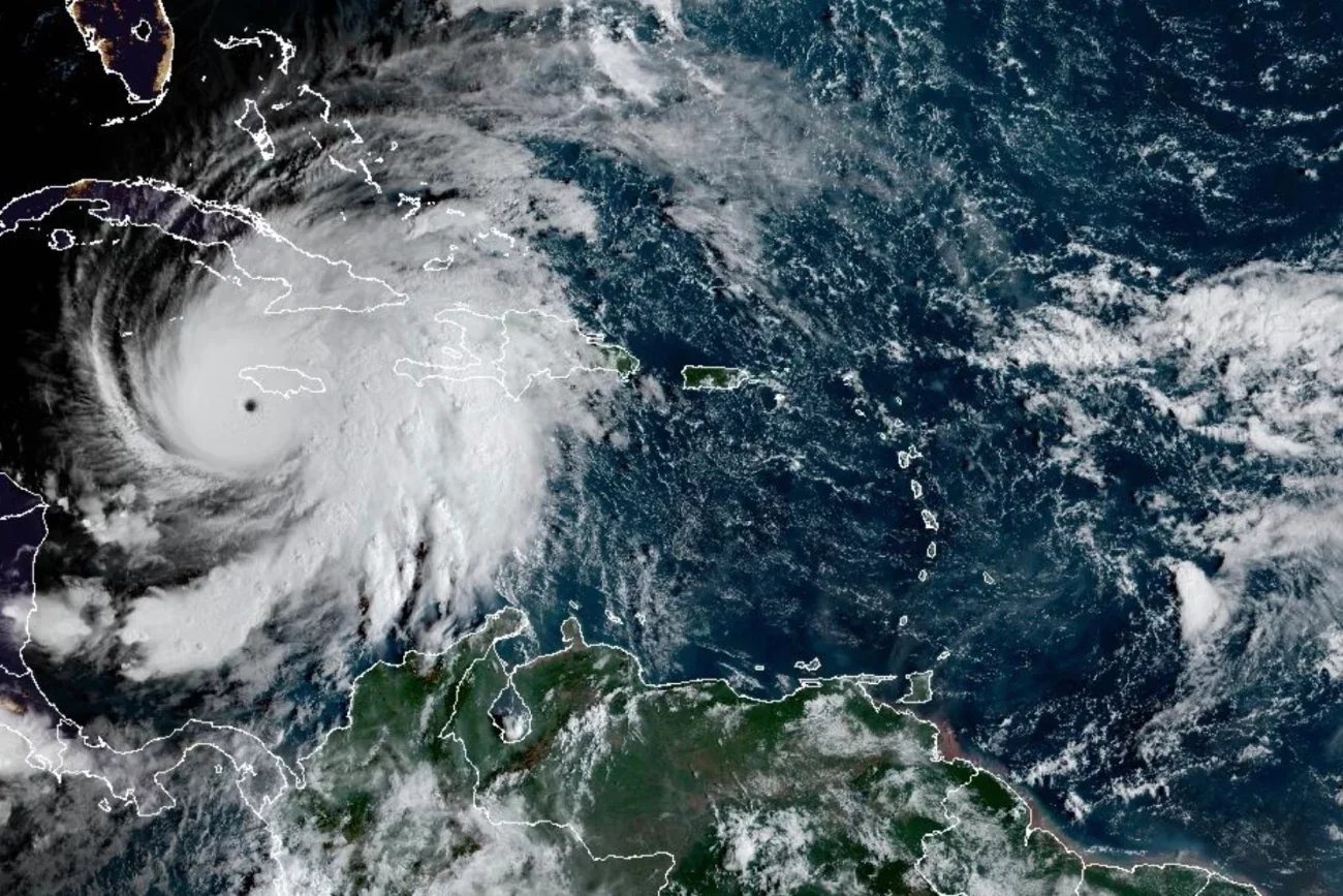
This satellite image provided by the National Oceanographic and Atmospheric Administration shows Hurricane Melissa, Tuesday, Oct. 28, 2025.
NOAA/via AP
KINGSTON, Jamaica — Tuesday, Oct. 28, 2025 — Hurricane Melissa roared ashore in southwestern Jamaica near New Hope on Tuesday afternoon as a Category 5 hurricane with estimated 185mph (295kph) sustained winds, carving a diagonal path across the island toward St. Ann Parish and on to eastern Cuba later tonight into Wednesday, according to forecasters.
Officials in Jamaica reported landslides, downed trees, and widespread power outages even before landfall. Prime Minister Andrew Holness warned that the task ahead will be measured in recovery speed, not survivability of infrastructure: “There is no infrastructure in the region that can withstand a Category 5… The question now is the speed of recovery. That’s the challenge.”
What To Know
Catastrophic surge & wind: The U.S. National Hurricane Center (NHC) warned of life-threatening storm surge up to 13 ft (4 m) along southern Jamaica and total building failures within Melissa’s core. Peak gusts in Jamaica’s highest terrain could approach 200 mph (321 kph).
Flooding & landslides: Forecasters caution of catastrophic flash flooding and numerous landslides in Jamaica, Cuba, and Hispaniola, with localized rainfall totals potentially topping 40 inches (102 cm) in mountainous areas.
Cuba next, then the Bahamas: Eastern Cuba faces late-Tuesday/early-Wednesday landfall with up to 20 inches (51 cm) of rain and dangerous coastal surge. The southeastern Bahamas could see impacts by Wednesday evening.
Record-tying intensity: Experts say Melissa’s 185 mph winds and ~892 mb central pressure at landfall tie records set by the 1935 Labor Day hurricane (pressure and wind) and 2019’s Hurricane Dorian (wind).
Climate signal: Exceptionally warm Atlantic waters helped Melissa double its wind speed in <24 hours, the fourth Atlantic storm this year to undergo rapid intensification, according to climate scientists.
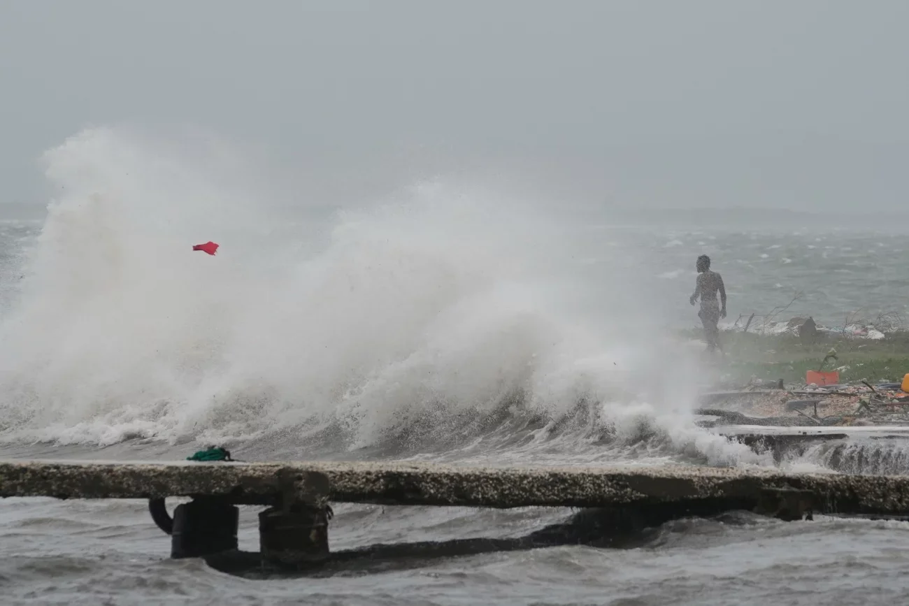
Waves splash in Kingston, Jamaica, as Hurricane Melissa approaches on Tuesday morning, Oct. 28, 2025.
Matias Delacroix/AP
Current Track & Status (Early Afternoon EDT)
Landfall: Southwestern Jamaica near New Hope; forward motion NNE ~9 mph (15 kph).
Proximity: About 25 miles (40 km) SE of Negril, ~145 miles (235 km) SW of Guantánamo, Cuba) at the time of the latest advisory.
Trajectory: A diagonal cut across Jamaica, exit near St. Ann, then on to eastern Cuba before turning toward the southeast Bahamas.
On The Ground In Jamaica
Residents in and around Kingston and Portmore described a relentless roar as power failed and debris began to fly. Officials urged the public to seek shelter and remain indoors: “Jamaica, this is not the time to be brave,” said a senior disaster official, noting boats and helicopters are staged for post-storm rescues. Radio airwaves filled with public-service messages, including a new reggae jam urging people to “Hold on, Jamaica!”
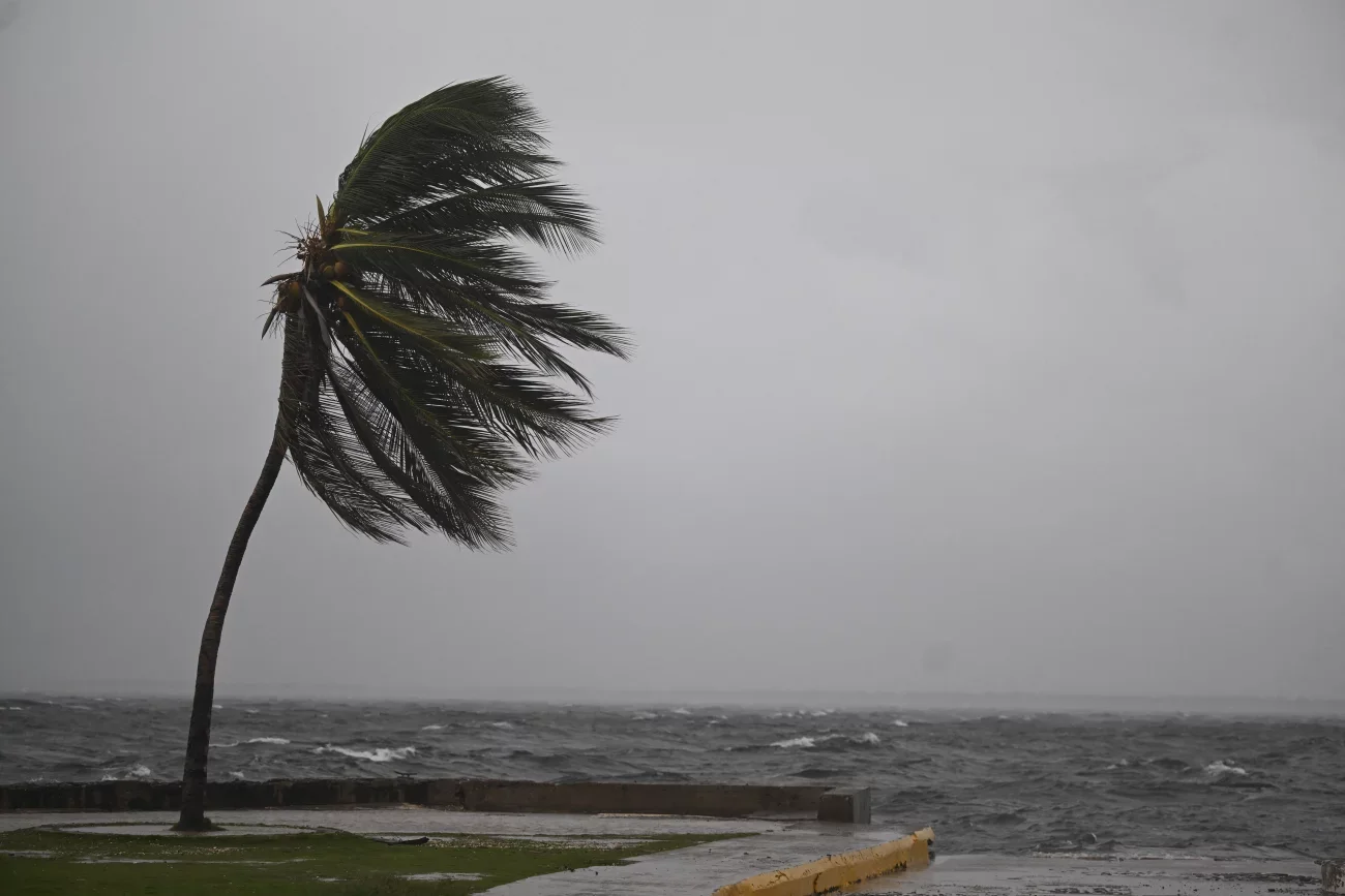
A coconut tree sways in the wind at the Kingston Waterfront on Ocean Boulevard in Kingston, Jamaica, as Jamaica starts to feel the effects of Hurricane Melissa on Oct. 26, 2025.
Ricardo Makyn/AFP via Getty Images
Regional Readiness & Evacuations
Cuba: Authorities plan to move ~500,000 people to safer ground across the east, with additional hundreds of thousands already queued for evacuation in provinces including Holguín and Banes.
Aid pipeline: U.N. agencies and NGOs have pre-positioned generators, field medic packs, tents, and medications for rapid deployment to Jamaica, Cuba, and Haiti once airports and seaports can reopen.
U.S. citizens: The U.S. State Department urged Americans in the storm’s path to “depart ASAP if still possible” or prepare to shelter in place.
Security & Continuity Lens (For Private Security Leaders)
Power & Communications: Expect extended grid outages and intermittent cell/data service. Pre-validate generator load, fuel reserves (72–96 hours minimum), and satellite/mesh communications for command posts and guard shacks.
Access Control: Switch facilities to manual badge/visitor logging, ensure mechanical overrides for gates/turnstiles, and pre-stage portable lighting at entries and egress routes.
Flood & landslide exposure: Re-map post-landfall patrol routes around hillsides, culverts, and known floodplains; do not dispatch solo units into debris zones. Use two-officer teams with high-visibility PPE and chainsaw/first-aid kits as trained and authorized.
Supply chain & cash handling: Anticipate port/airport closures and delayed armored transport. Coordinate with clients on cash-light operations, ATM service suspensions, and increased CCTV remote monitoring to offset reduced on-site staffing.
Client Communications: Push hourly status bursts (power, perimeter, incidents, staffing) to client execs and facilities teams. Maintain a dedicated incident channel for emergency services handoffs.
Post-storm posture (0–72 Hours): Prioritize life safety, debris hazards, structural checks, and generator security (fuel theft risks). Prepare for curfew compliance support where issued. Coordinate only with official directives.
Editor’s Note For Our Readers
Continue to follow official guidance from local disaster agencies and the NHC.
Private security leaders should activate storm SOPs, document all actions for after-action reviews, and coordinate closely with utilities and public safety partners before redeploying field teams post-passage.
This report compiles official advisories, on-the-ground accounts, and expert analyses provided in today’s briefings.